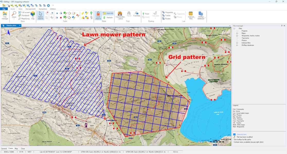
Why Use an Area Coverage Route?
In many activities, simply following a trail or reaching a specific location is not enough: you need to cover the entire area of interest without leaving any unexplored zones. Manually drawing a track made up of dozens of parallel passes is time-consuming, prone to errors, and often results in unnecessary overlaps or uncovered areas.
An automatic GPS track generator creates an optimized route in just a few seconds, adapting it to the shape of the selected area. The resulting track can be saved as a GPX file, loaded onto a GPS navigator, or used directly with OkMap Mobile or other compatible applications.
Lawn Mower Pattern
The lawn mower pattern consists of a series of parallel passes traveled alternately in opposite directions, allowing complete coverage of the area with the fewest possible turns.
It is the ideal solution when the goal is to inspect, photograph, or systematically survey a surface. This pattern is widely used in many fields, including:
- hiking and environmental monitoring;
- GPS and land surveying;
- drone photogrammetry;
- precision agriculture;
- inspection of land, facilities, or natural areas.
Grid Search
A grid search extends the lawn mower pattern by adding a second series of passes, usually oriented at 90 degrees to the first. This way, every point in the area is covered from two different directions, increasing the likelihood of detecting people, objects, or other targets of interest.
This pattern is particularly suitable when thorough coverage is more important than execution speed, such as during search and rescue operations, technical inspections, or environmental surveys.
When to Choose One Method or the Other
The choice mainly depends on the purpose of the activity and the required level of coverage.
| Activity | Recommended Method |
|---|---|
| Hiking and environmental monitoring | Lawn mower pattern |
| GPS and land surveying | Lawn mower pattern |
| Drone photogrammetry | Lawn mower pattern |
| Search for missing persons | Grid search |
| Civil protection | Grid search |
| Highly detailed inspections | Grid search |
Coverage Path Planning
In robotics, this problem is known as Coverage Path Planning (CPP), which is the automatic planning of a route capable of completely covering an area while minimizing overlaps and unexplored zones.
The same principle is used by robotic vacuum cleaners, autonomous agricultural machines, drones for photogrammetric surveys, and automatic inspection systems. OkMap applies this concept to GPS track generation, allowing you to automatically create optimized routes based on the boundary of the area to be explored.
Automatically Generate a GPS Track with OkMap
In OkMap, simply draw the boundary of the area and choose the desired route type. The program automatically generates the track following the geometry of the polygon and lets you configure parameters such as the distance between passes, the route orientation, and the maximum distance between track points.
Once generated, the track can be edited, analyzed, exported as a GPX file, or transferred directly to GPS navigators and mobile devices for field use.